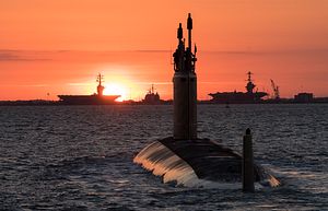
A new Chinese undersea surveillance network is gathering oceanographic data stretching from the Western Pacific into the Indian Ocean, according to new reporting from the South China Morning Post. The network appears to be part of a much broader Chinese effort to improve its undersea warfare capabilities and erode the advantage that the United States’ advanced submarines provide it.
Earlier reporting on a part of this network covering the East and South China Seas emphasized its scientific mission while acknowledging it would contribute to China’s national defense. The network merges data collected by buoys, ships, satellites, and unmanned underwater gliders for analysis and use by the Chinese navy.
The United States also operates unmanned underwater gliders to collect oceanographic data, one of which was seized by the Chinese navy in December 2016 near the Philippines while it was being retrieved by a U.S. Navy oceanographic research vessel.
Turning Science into Military Advantage
The United States regards its mastery of undersea operations as one of its key strategic strengths against a major power like China. Admiral Harry Harris, head of the U.S. Pacific Command, has testified before Congress about the importance of U.S. submarines’ “asymmetric advantage” to counter threats like potential Chinese coercion.
That broader strategic advantage is enabled in part by an extensive network of naval oceanographic support to provide an “asymmetric war fighting advantage” to the submarines, planes, and ships that detect and track potential adversary submarines.
Underwater listening devices and passive sonar systems detect and track ships and submarines by listening for the sound they emit. To increase the accuracy of those systems, operators need to understand how that sound was distorted by changes in things like temperature, pressure, and salinity as it traveled through the water. To accurately model the ocean and predict how sound will travel through it requires both accurate charts of the undersea topography and vast amounts of oceanographic data to understand local water characteristics and to predict how those characteristics are likely to change over time.
China’s new oceanographic network and recent spate of hydrographic surveys appear designed to collect that data, not to directly detect submarines, like the networks of hydrophones that the United States installed on the sea floor during the Cold War to listen for Soviet submarines.
China Surveying Strategic Waters in Western Pacific
China has undertaken several recent hydrographic surveys to map the ocean bottom, particularly around strategically important waters near the Philippines. Chinese survey vessels were found operating in the vicinity of the Luzon and Surigao Straits in early 2017. In a potential clash with the United States, Chinese control of these straits would be critical alternately allow Chinese submarines to “break out” into the Western Pacific, and to block U.S. ships and submarines from flowing into the South China Sea to respond to the sort of coercive contingency that Admiral Harris is concerned about.
Further out, China also recently conducted its first acoustic research in the Marianas Trench, site of the ocean’s greatest depths, and at about 170 nautical miles from Guam, within the United States’ Exclusive Economic Zone (EEZ). Chinese scientists used unmanned probes to study the transmission of sound at depths over 5 nautical miles down. While the research was not explicitly military, understanding deep-sea sound propagation has application in submarine communications and improving the oceanographic models that aid sonar detection and tracking of other submarines.
Last summer Chinses hydrographic survey vessels mapped some of the same waters near the Caroline Islands, activity that prompted observation by U.S. reconnaissance planes. The project’s lead researcher told the South China Morning Post that the surveys were part of a larger strategic effort to enable the Chinese military to operate deep into the Western Pacific and breach the Second Island Chain that stretches from Japan through the U.S. territories in the Marianas Islands.
New Data for New Tracking Capabilities?
Photographs published earlier this year showed new catamaran-style ocean surveillance vessels under construction in a shipyard near Hong Kong. The vessels appear striking similar to U.S. long-range submarine tracking ships like the USNS Impeccable, which was famously harassed by a combination of Chinese military, law enforcement, and paramilitary units while operating in the South China Sea in 2009.
The United States has operated its fleet of Ocean Surveillance ships in the Western Pacific for years, to strident Chinese opposition that has occasionally flared into overt harassment, as happened to the Impeccable. The surveillance ships are not armed themselves, and in a conflict, warships, planes, and submarines would be directed to engage the adversary submarines using their information. By constructing similar vessels, China may be trying to develop capabilities to turn the tables on the United States’ submarine advantage.
To do their job well, sub-tracking ships like China appears to be constructing will need detailed ocean models and the ability to apply them tactically, something that the United States has built up decades of experience doing. Whatever obstacles the Chinese military will face operating new anti-submarine capabilities, China’s oceanographers are busily doing their part collecting information about the depths of the Western Pacific.


