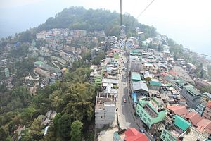
Forty years ago, in 1975, India annexed the Himalayan territory of Sikkim, which then became India’s 22nd state.This annexation was made official by an amendment to the Indian constitution on May 15, 1975 after a referendum; you can read more about that in this article at The Diplomat by Ankit Panda. In essence, due to migration, ethnic Nepalese came to be the majority of the population in Sikkim, outnumbering the native Sikkimese (Bhutias and Lepchas, who are related to Tibetans). This lead to the overthrow of the Chogyal, the hereditary Bhutia Buddhist monarch and Sikkim’s merger with India.
But what exactly was Sikkim before it joined India? Was it truly independent, or only somewhat so? Officially, it was a protectorate of India. Sikkim and the cases of Arunachal Pradesh, Kashmir, and Tibet, all raise interesting questions about the nature of sovereignty in the Himalayas, a region whose territories only became defined by clear borders and Westphalian norms of territoriality in the last century. These questions are especially worth examining in light of Indian Prime Minister Narendra Modi’s trip to China, where he and Chinese President Xi Jinping will discuss border issues (though these will not take center stage).
Historically, the Himalaya region was not controlled directly by the states on both sides of the mountains, in present day China and India. Historically, Chinese and Indian states had different models of territorial control. Chinese empires tended to feature strictly defined territories in which all provinces were equally controlled by the central government, though tributary states of varying degrees outside of the empire were permitted (since in theory, the emperor was the ruler of “all under heaven”). On the other hand, Indian states generally operated on some variation of the mandala model, which was also exported to Southeast Asia, and the Himalayan region itself. In this model, power and sovereignty became ever more diffuse in a series of concentric circles as one moved further away from a state’s central region of control. In many areas, personal relationships of subordination mattered more than official territorial distinctions and often states and rulers were subject to and masters over several different powers. Because this system prevailed in the Himalayas, mapping it onto a modern state system of defined boundaries was bound to cause confusion and problems.
In practice, notions of territory in the Himalayas meant that both Chinese and Indian states exercised direct sovereignty only up to the foothills of the Himalayas: western Sichuan province on the Chinese side of the mountains, and the Terai belt of foothills and forests north of the Ganges valley running through modern India and Nepal. Beyond that, literally hundreds of independent entities existed in the mountains, all with varying degrees of control over and suzerainty to each other, to China, to Indian states, and to the larger independent Himalayan states like Tibet (which itself was often a loose collection of semi-independent kingdoms). The point is that the Himalayan region, which contains the world’s highest mountains, was often an entire microcosm unto itself, isolated and independent from the rest of the world. Certainly, it was a barrier mighty enough to prevent any direct political contact between India and China until the 20th century.
By 1700, I estimate there were hundreds of states in the Himalayan region: Ladakh, Mustang, Bhutan, Sikkim, the three city states of the Newar (Nepal) valley, multiple kingdoms in the Kumaon region of today’s Uttarakhand in India, the Chaubisi confederation of 24 independent principalities in central Nepal, Guge in western Tibet, multiple rulers in Amdo, in today’s Qinghai province in China, and so on. I name all these to emphasize the multiplicity of states in the region in order to belay any modern country’s claim of long sovereignty over the region.
Yet, over the course of the past few centuries, most of this region came under the control of modern states and their predecessors. This lead to a situation where it was clear that the multiple Himalayan territories were subordinate to states like the Qing Empire (which placed an amban in Lhasa in the 1720s to oversee the region and prevent it from being ruled by the Dzungar, a Mongol confederation), Nepal, British India, the princely state of Jammu and Kashmir (Sikh Empire-ruled Kashmir conquered Ladakh in 1834), and so on.
At the same time, though, the nature of their subordination was never clearly laid out. The British most often used the word “suzerainty” to describe China’s relationship to Tibet, which implied Chinese control over the foreign policy of an autonomous Tibet. Tibet’s relationship to China was closer than that of a tributary but independent state like Korea but not it was obviously not a Chinese province. With the British also claiming suzerainty over many Himalayan areas during the British Raj, many Himalayan rulers were essentially in subordinate relations with the British, the Dalai Lama, and the Qing Emperor all at once, despite recognition of zones of influence. The position of today’s disputed areas such as Aksai Chin and Arunachal Pradesh is thus ambiguous from a historical perspective.
It is important to keep this in mind when trying to sort out and discuss territorial boundaries in this region: nothing is clear cut. But ultimately clear lines will have to be drawn by some mechanism, and when this happens, modern states should keep in mind which powers the region’s states were generally tributaries of or linked with historically. As for Sikkim’s status: well, it was complicated.


