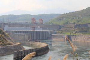
As the Mekong River becomes the focus of renewed geopolitical rivalries, a new U.S.-funded river monitoring platform aims to shed light on controversial Chinese dam-building activities on the river’s upper reaches.
The Mekong Dam Monitor, which was officially announced on December 14, will employ remote sensing and data from cloud-piercing satellites to track water levels in China’s dams, which have been accused of withholding water from downstream nations.
This project, a joint venture between the Washington-based Stimson Center and the American research firm Eyes on Earth, is part-funded by the U.S. State Department and will be officially launched on December 15.
It comes after a year that has seen increasing global scrutiny on China’s cascade of 11 mega-dams dams on the Lancang, as Beijing refers to its stretch of the 4,350-kilometer river. Since last year, the lower Mekong nations have been wracked by a severe drought that has seen stretches of the river along the border with Laos and Thailand dry up entirely. This followed another record dry-spell in 2016. And recent evidence shows that China’s upstream dams are at least partly to blame.
In April, Eyes on Earth published a study claiming that Chinese dam reservoirs had held back excess monsoon rains, exacerbating drought conditions in the five downstream nations where more than 66 million people rely on the Mekong’s resources.
“For six months in 2019, while China received above average precipitation,” the report concluded, “its dams held back more water than ever – even as downstream countries suffered through an unprecedented drought.” The report was jointly commissioned by Washington’s Lower Mekong Initiative – since upgraded and rebranded as the U.S.-Mekong Partnership – and the United Nations-backed Sustainable Infrastructure Partnership.
Brian Eyler, the director of the Stimson Center’s Southeast Asia Program told The Diplomat that the monitoring platform would provide a clearer picture than ever before on the impacts of China’s upstream dams. Like Stimson’s handy Mekong Infrastructure Tracker, it will also be available to the public.
“This will be a game changing platform,” he said. “For the first time we will have weekly data on all of China’s dams. And users will see/corroborate the data with their own eyes via satellite images.” The platform will also monitor water levels for the 15 dams on the lower reaches of the river. “We will know where the water is at any one time and better understand the impacts of upstream dam operations,” Eyler added.
But there is some risk of the new platform being drawn into the mounting strategic rivalries between Washington and Beijing. Since the release of the Eyes on Earth report, its findings have been taken up by the Trump administration in an attempt to turn regional opinion against China.
For its own part, the Chinese government has dismissed the report’s findings, asserting its own research that water stored in reservoirs during the flood season has actually helped prevent both downstream floods and droughts. “The United States has been unable to provide good evidence throughout,” the state-backed China Renewable Energy Engineering Institute said in a recent report. (Some aspects of the report’s methodology have also been questioned by independent researchers, as well as the Mekong River Commission.)
In response to downstream nations’ concerns, Beijing has also pledged to share year-round hydrological data with downstream nations, launching an online data sharing portal, under the slogan “Shared River, Shared Future.
Despite the strategic sensitivity surrounding Chinese activities on the Mekong, the new dam monitor will clarify the exact impacts of China’s upper Mekong dams on those living downstream, and make it more possible for lower Mekong nations to hold China’s official data to account. In the best case scenario, it could push the Chinese government to ameliorate the impacts that its dams are having on downstream nations. If so, it would be a welcome reprieve for Southeast Asia’s great river.


