


")


Amid a pandemic and attendant global economic and social chaos last year, the China-India standoff in Ladakh, which now shows modest signs of ending, did not draw as much attention as it should have – not the least because at least on one occasion, the two nuclear-armed Asian behemoths came very close to a shooting war. While most explanations of the standoff, such as they are, have focused on relatively contemporary causes, ranging from recent Indian actions to Chinese grand strategic calculations, a simple fact remains: The history of Ladakh and colonial British geopolitical ideation has had much to do with India’s northern frontiers remaining a convoluted mess, resisting clear solutions. If geography is one half of the problem, history is the other half. Geopolitics, as a juxtaposition of power and space (as writer Robert Kaplan once famously put it), is equally shaped by both – and by conceptions of spatial power in general, past and present.
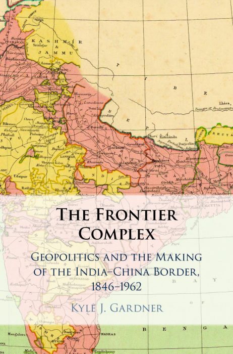
In a recently published book, “The Frontier Complex: Geopolitics and the Making of the India-China Border, 1846-1962,” Kyle Gardner provides a careful, scholarly account of Ladakh’s geopolitical history, drawing on a range of historical sources. Gardner, a non-resident scholar at the Sigur Center for Asian Studies, George Washington University, recently spoke over email with The Diplomat’s Security & Defense Editor Abhijnan Rej on how the region’s contestations emanate from imperial geopolitics, and how the past may, or may not, not hold the key to lasting peace there.
In your new book you write how colonial British cartography sought to transform Ladakh, which has often been described as the “crossroads of High Asia” – one where India meets Central Asia – into a “fractured and disputed borderland.” Can you please tell our readers how such an attempt might have been the original sin, so to speak, when it comes to geopolitical disputes that persist till date?
The roots of today’s border dispute in Ladakh can be traced back to the 1840s and the creation of the princely state of Jammu and Kashmir by the British East India Company. From 1846 until India’s independence in 1947, colonial officials repeatedly tried to survey and map a suitable borderline for the northern limit of their empire in India. But they ran into complications.
First, British expectations deviated from local understandings of borders. Ladakh had long-standing border points (such as at Demchok and the Zoji Pass) located along the trade routes that had made the region an economic and cultural crossroads. These border points functioned as sufficient markers of territory for a region entered through mountain passes (the name Ladakh translates as “land of passes”). But this absence of a complete borderline also meant that the status of much of the arid plateau east of Ladakh remained ambiguous (this is the area now generally referred to as the Aksai Chin). And the political status of this “no man’s land” was equally vague to the governments of Tibet and the Qing Empire. In other words, there was no political map of the region until the British attempted to produce one.
Second, the topography of eastern Ladakh and the Aksai Chin afforded no neat geographical features to use for fashioning a borderline. While the British spent a century developing border-making principles that were often successfully applied elsewhere, they failed in Ladakh. This legacy of failure and the borderless maps that reflected it were inherited by independent India in 1947 and, shortly thereafter, by the People’s Republic of China.
What were the key cartographic practices the British used in Ladakh and elsewhere in the northern frontiers of colonial India?
 Much of the mapping of India was completed under the Great Trigonometric Survey of India, which as the name suggests involved stitching together lots of precisely measured triangles to better plot the subcontinent onto a cartographic grid. But the harsh environment of the Himalayan region made surveying more complicated and required the use of less precise “traverse” surveys. As a result, the mapping of this region was less comprehensive and precise than that in the plains of India.
Given the encroachment of the Russian Empire by the late 19th century, much of the “trans-frontier” surveying became covert, tied to the growth of a security regime in India that restricted access to frontier regions and increasingly restricted access to information about it. Much of this surveying was accomplished by the Pundits, Indian surveyors who often employed secretive means to record information about the territorial edges of India. But this also meant that the details on frontier maps were less consistent, making it difficult to integrate this information thoroughly into the trigonometrical surveying completed by the Survey of India throughout the plains.
In Ladakh, specifically, much of the survey data used to inform colonial map making was generated from a handful of traverse surveys undertaken by a very small number of surveyors. Thus, certain assumptions about the topography of the Aksai Chin generated from, for instance, a single survey in 1865, would inform maps depicting the region for decades. Ladakh was perceived to be more peaceful than the northwestern or northeastern frontiers, so uncertainty about its precise limits could be tolerated more easily by the colonial state.
Can you tell us a little bit more about the water-parting principle and how the British sought to use it in Ladakh and elsewhere, in the eastern Himalaya?
The 19th century witnessed a revolution in geography. Partly, this was driven by developments in fields like hydrology, geomorphology, and ecology, and by practical things like improved surveying equipment and advancements in mapping techniques. But above all it was driven by European imperial (and American) territorial expansion. This led to the development of border-making principles that took advantage of new ways of thinking about natural features like mountain and water systems. The water-parting principle exemplifies this, a border-making rationale based on the concept of the watershed and the idea that the limit of a watershed typically aligns with the ridge line of a mountain range. Employing this principle was assumed to be the most systematic and precise way of using natural features to define political territory. But the water-parting principle broke down in the Aksai Chin and in parts of the eastern Himalaya, where further surveying revealed that the mountain ranges were not co-terminus with the limits of the watershed.
To what extent did British desire to create buffer zones in the face of imperial Russian power shape how Britain saw the northern frontiers of colonial India?
Unlike [contemporary] India, which views — like all nation-states — the securing of its borders as an existential and sovereign concern, the British Empire often accepted a degree of ambiguity in the management of its frontiers. But that is not to say that the British weren’t deeply worried about Russian encroachment (despite what the lighthearted term “Great Game” might imply with respect to their imperial rivalry). Outside of India, the British invaded neighboring states such as Afghanistan, Nepal, Bhutan, and Tibet to “encourage” them to act as buffers against Russian and, to a lesser degree, Chinese encroachment.
Within India, the British configured its indirectly ruled princely states to perform a similar function — at least for those frontier states like Jammu and Kashmir. But having indirectly ruled states along the imperial periphery also complicated the ability of the British to satisfactorily control their frontiers given the formal autonomy that princely states were afforded. By my count there were at least seven times when colonial administrators proposed taking direct control of frontier territories, or at least creating a directly administered “buffer zone” along their edges to better oversee them. But like many government decisions, budgetary constraints often overrode security concerns.
Coming to contemporary concerns, and given the complex history of Ladakh in general, how confident are you that even if the ongoing China-India standoff there is resolved for now, that a more permanent solution to the China-India boundary dispute across the entire Line of Actual Control can be found in the near future? Is topography destiny?
Historians tend to get nervous around forecasting questions. If the past does offer any hints for a possible resolution to the border issue, it would be in emphasizing the obvious point that any resolution would requires both sides to see it in their best interest. The British attempted to define a border unilaterally and failed. After Indian independence in 1947 and before the war between India and China in 1962, there were moments when it appeared that China was receptive to addressing the issue of the missing border. But since 1962, India has generally been the more receptive party — China much less so.
In practice, the Line of Actual Control functions less as a borderline and more like a colonial-era frontier, liable to shifts and confusion over who occupies what. If the history of the region shows just how deep the roots of the border problem run, it doesn’t yield an easy solution. But just because the topography of the Aksai Chin doesn’t afford a neat natural line to use as a border, it doesn’t mean that both sides can’t come up with a borderline that can be respected. After all, the logic to much of the U.S.-Canada border is an artificial line of latitude.
But that verges into the realm of diplomatic solutions. For both sides to agree to demarcate the border, India and China would need to see it in their interest to do so. At present China has found an easy way to get India’s attention — and to distract it, frankly, from other geographies (i.e. the Indian Ocean). It is not clear why China would, at present, deviate from this arrangement.
The border issue is further complicated by the territorial claims that underpin it, but these claims could hypothetically offer a solution. Both sides claim territories occupied by the other (India claims Chinese-administered Aksai Chin, China claims Indian-administered Arunachal Pradesh). If the definition of a compromise is an arrangement in which neither side is fully happy with the outcome, affirming the territorial status quo with respect to these territorial claims seems like the perfect compromise. But convincing the citizens of India and China to back such a deal is another matter.